
Lee John
Lee John - Victorian Maps Of England The County And City Maps Of Thomas Moule - Hardcover
Lee John - Victorian Maps Of England The County And City Maps Of Thomas Moule - Hardcover
Books
Regular price
$26.58 USD
Regular price
Sale price
$26.58 USD
Unit price
per
Shipping calculated at checkout.
Couldn't load pickup availability
Binding: Hardcover
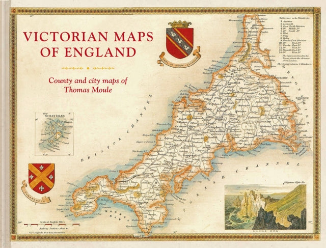
Description: The most beautiful Victorian maps of England's counties and cities in large format by one of Britain's great cartographer's Thomas Moule. Thomas Moule was one of the finest Victorian mapmakers and is regarded as the true follower of John Speed in the cartographic history of Britain. Moule's beautifully observed county and city maps present a minutely detailed record of 19th - century England. They were first published in collectable parts between 1830 and 1837 and then published together in the extensive 2 - volume masterwork The English Counties Delineated. Moule celebrated the ancientness and history of each county by including pastoral or monument views within the maps all framed by cartouches festoons and architectural ornament in a variety of historical styles. But underpinning this ancient vision is the hand of the British Industrial Revolution. Moule's maps are deeply informed by the early technical work of the Ordnance Survey and record the unstoppable growth of the major cities and the unrelenting spread of the railways. The maps have remained influential and highly collectable as both originals and as reproductions. For the first time in a generation this new large - format volume comprising 55 county and city maps presents the main body of Thomas Moule's work alongside his original detailed text descriptions. The book's Introduction explains Moule's career as a writer and antiquary and sets his celebrated maps in the context of the technical cartographic revolution in which they were published. The book examines the wide - ranging artistic and cultural influences exhibited as Moule combines accurate cartography with highly decorative architectural frames and evocative Romantic pastoral views of the England he so cherished. In doing so it positions him alongside his fellow celebrated Victorian pioneers including George Virtue William Westall Walter Scott Charles Dickens JMW Turner Augustus Pugin Edward Stanford and George Bradshaw.
Title: Victorian Maps Of England The County And City Maps Of Thomas Moule
Author(s): Lee John
Publisher: Batsford Ltd
Barcode: 9781849944977
Pages: 160 Pages
Publication Date: 9/6/2018
Category: Historical Maps & Atlases
Description: The most beautiful Victorian maps of England's counties and cities in large format by one of Britain's great cartographer's Thomas Moule. Thomas Moule was one of the finest Victorian mapmakers and is regarded as the true follower of John Speed in the cartographic history of Britain. Moule's beautifully observed county and city maps present a minutely detailed record of 19th - century England. They were first published in collectable parts between 1830 and 1837 and then published together in the extensive 2 - volume masterwork The English Counties Delineated. Moule celebrated the ancientness and history of each county by including pastoral or monument views within the maps all framed by cartouches festoons and architectural ornament in a variety of historical styles. But underpinning this ancient vision is the hand of the British Industrial Revolution. Moule's maps are deeply informed by the early technical work of the Ordnance Survey and record the unstoppable growth of the major cities and the unrelenting spread of the railways. The maps have remained influential and highly collectable as both originals and as reproductions. For the first time in a generation this new large - format volume comprising 55 county and city maps presents the main body of Thomas Moule's work alongside his original detailed text descriptions. The book's Introduction explains Moule's career as a writer and antiquary and sets his celebrated maps in the context of the technical cartographic revolution in which they were published. The book examines the wide - ranging artistic and cultural influences exhibited as Moule combines accurate cartography with highly decorative architectural frames and evocative Romantic pastoral views of the England he so cherished. In doing so it positions him alongside his fellow celebrated Victorian pioneers including George Virtue William Westall Walter Scott Charles Dickens JMW Turner Augustus Pugin Edward Stanford and George Bradshaw.
Title: Victorian Maps Of England The County And City Maps Of Thomas Moule
Author(s): Lee John
Publisher: Batsford Ltd
Barcode: 9781849944977
Pages: 160 Pages
Publication Date: 9/6/2018
Category: Historical Maps & Atlases